Street Life: Groningen (The Netherlands)
The Diepenring as start page for the Groningen city centre
Tjerk Ruimschotel
A virtual metaphor for a concrete project
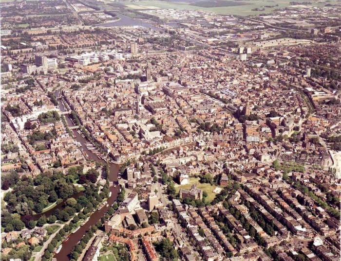
Within an area of approximately one square kilometre the city centre of Groningen manifests itself as a variegated mix of functions and projects. The centre is still the urban focus for more than half a million inhabitants of Groningen and its surroundings. Up until now the edge of the city centre has been regarded as the Diepenring. This historic ring of waterways and routes around the historic core is mainly used as a feeder route for a number of parking garages. The redesign of the public areas of the Diepenring is a key project in the city. For this project the metaphor 'website start page' is used as an impetus to the new design of this gateway to the city centre.
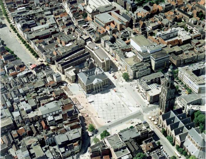
The context: vision on the city centreAt the end of the 1970's a large scale restructuring of the public space was begun by removing cars from the city centre. The city centre became more accessible and attractive, a fact that can mainly be observed in the busy public transport, the number of cyclists and pedestrians, and the large concentration of hotels, cafes and restaurants around one central point: the Grote Markt.
It is obvious that the city centre must retain its position while at the same time other, new central areas are emerging. But the city centre must be more than a consumer's paradise of urban leisure and entertainment. The historic core has therefore been developed and managed as a variegated housing, employment and leisure environment in which many types of productive, recreational and consumer-oriented land use are possible.
Following the initial improvements in the last decades of the 20th century, a second wave of improvement in the modern use of the city is necessary. The expansion of the ambitious 'Better City Centre' project to areas outside the pedestrian precinct and even outside the traditional boundaries of the city centre is intended to produce additional space for spontaneous use. This is a new, not necessarily architecture-oriented approach that will have tangible meaning for the various uses the city centre has as a whole.
In the municipal vision on the City Centre a coherent strategy is formulated to interconnect a number of existing, more or less independent, programmes and projects. This is done in such a way that a new mental map, which emerges of the city, makes spontaneous use (in space and over time) easier. The Diepenring is then as it were the start page of the Groningen website where you automatically drive, cycle or walk to. To follow the metaphor of the website through: with a simple double click you should come to the place you want in or outside the Diepenring.
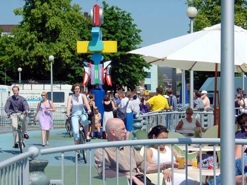
The relevance of street life: life on the streets
In the municipal vision on the City Centre the fourth dimension of the city (the factor of time as an expression of constantly changing use) is one source of inspiration. The hardware has over the course of the centuries been expressed in a two dimensional map of the city with the three dimensional buildings on top. For the most part the software of the day-to-day and specialised use of the city centre was also already developed and laid down in land use plans, traffic regulations and other forms of control and inducement.
We are now concerned with organising the future use of the city in space and over time in such a way that automatically a large number of, sometimes mutually exclusive, activities can take place, sometimes simultaneously, sometimes in succession. This 'org-ware' is not only related to more and more mass consumption, but also to individual forms of leisure and entertainment in the city. Street life, or in other words: life on the streets, appears to be a success or failure factor in the functioning of the city at all scales and in all environments. The city centre is no pre-fabricated thematic fun park, but a vital and organically functioning living environment where important urban functions are brought together. Concentration and differentiation are key concepts in this: for the Diepenring, for example, an idea is to construct an extra 50% dwellings in 10 years in order to make this the most urban part of the city and the living environment for a large proportion of the population of Groningen.
To breathe more life into the city centre, at the same time important reconstruction projects are being developed contiguous to the city centre. Some of these have already been realised (Westerhaven), others are in the early phases, such as the Central Station area and the Sontplein. Urban reconstruction projects being implemented are the CiBoGa area and the Europapark. On the former Circus, Boden and Gasworks site (CiBoGa) an exceptional urban residential environment is being created close to the city centre for large scale retail functions, for which there is no place in the city centre. In the Europapark a number of disused industrial areas are being converted into multifunctional urban areas including for instance a new stadium for the Groningen football club and other uses connected to sport and entertainment. These are the urban foci of the future, not as imitations of the city centre where everything is available, but places in the city with a particular emphasis on a certain type of large-scale activity.
Challenge and programme of the project
The most striking project at the moment is the redevelopment of the environs of the Grote Markt. Recently a symbol of the municipal goal to continually upgrade the city centre, while at the same time giving the citizens the right to amend public plans via a unique Dutch form of referendum. Other projects relate to city marketing and the promotion of cultural tourism to share the qualities of the central urban environment. In the mix of city centre facilities certain themes are being attached to certain areas of the city, so that instead of a rigid deterministic juxtaposition of land uses adjacent to each other (zoning), open principles of overlap of uses, hybrids and random uses apply. In addition, concrete work is being done on making railway stations, public transport interchanges, parking garages and other areas more attractive as gateways to city centre functions and to allow activities to start up there.
Adjacent to and in part in contrast to this centre-oriented approach is the project for the Diepenring, that, as it were, encircles the city centre and is the interface between the various functions and land uses within and without the ring. An inspirational paradox in the development of this project is the fact that the Diepenring does not exist, at least not as a continuous circle. The Diepenring is at one and the same time a parking route and a number of interconnected waterways.
The two systems come together partly in one spatial profile (largely on the north and east sides); they run partly parallel to each other, but each with its own character: on the west side of the city centre a parking route runs along the line of the former fortress while the water of the river A flows through a virtual interior space. On the south side the Diepenring is divided into three parallel routes: the filled-in Zuiderdiep, the only space in the historic core of the city that is used as a traffic artery, then the royal crescent of the green canals (around the Groninger museum) with outside these the edge of the city centre in the form of the Verbindingskanaalzone with on both sides wide vistas over the 'waterpleinen' (water squares) of the Zuiderhaven and Oosterhaven and in between contact with the central railway and bus stations.
The Diepenring redevelopment project is based on the ambiguous character of the ring as a result of the large number of developments over history. By working on the spatial detailing of the various constituent parts, the Diepenring can become a coherent element in the city by forging both physical and virtual relationships (links) with the different functional and programmatic layers of the city.
Virtual strategy and concrete results
After the city of Groningen extended its physical boundaries in 1990 via the 'Stadsmarkeringen' project, the 'A Star is Born' project in 1996 (with subtitle 'The City as a Stage') attempted to anchor the cultural relevance of the open space in the consciousness of the city inhabitant and visitor. Urban planning is more than design: urban planning is also a strategy for urban development and management. It is the task of the responsible public authority to ensure via collective arrangements that also less aesthetic and ethical aspects of big city life (tramps, noise, prostitution etc.) have a place without taking over the public domain or making it unliveable.
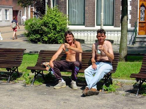
An illustrative part of the Diepenring project in this context is the so-called '365 Benches project'. One of the strategies most widely applied to keep a check on the nuisance from the homeless is to physically make it impossible for that nuisance to take place; for example by placing no more benches or providing spaces for sitting but not for lying down.
The most interesting project in the 'The City as Stage' project was the Blue Bench of Manuel de Sola-Morales, which at present cannot be implemented because of 'perceptions of nuisance'. To counteract this shameful repression, a creative form of spatial overkill has been suggested, namely to provide so many benches that should all the homeless take possession of a bench, enough are left over for other inhabitants and visitors. For Groningen a factor of 5 was applied to the regular number of homeless (75), making 365 benches, one for every day.
On the basis of a socio-spatial analysis of areas along the Diepenring, with the design of this surplus of benches both predictable and spontaneous activities are stimulated as equal forms of urban land use. After all in the end we are all, whether possessing a fixed abode or not, surfers on the wave of time.


Related articles:
- Street Life: Cosenza (Italy)
- Street Life: Dublin (Irland)
- Street Life: Graz (Austria)
- Street Life: Leeds (United Kingdom)
- Street Life: Munich (Germany)
- Street Life: Nijmegen (The Netherlands)
- Street Life: Porto (Portugal)
- Street Life: Regensburg (Germany)
- Street Life: Salerno (Italy)
- Street Life: Strasbourg (France)
- Street Life: Turin (Italy)
- Street Life: Vienna (Austria)


Planum
The Journal of Urbanism
ISSN 1723-0993
owned by
Istituto Nazionale di Urbanistica
published by
Planum Association